Flood Insurance – What has Changed
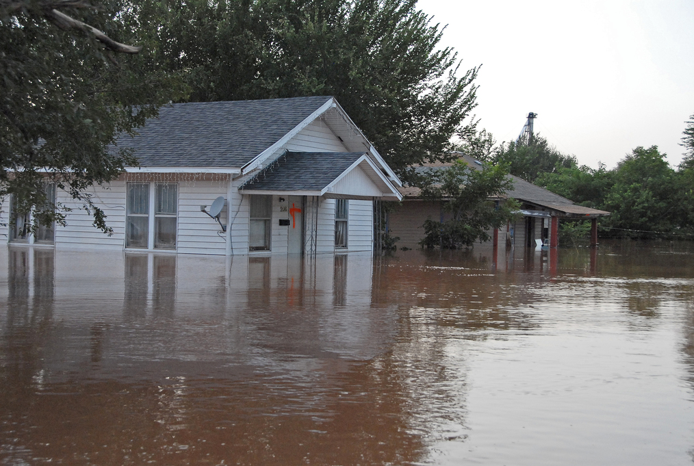 Flood insurance is required for properties located within an A Zone or V Zone, collectively referred to as a Special Flood Hazard Area (SFHA), and are mortgaged through a federally regulated or insured lender. Properties within a Special Flood Hazard Area have a 1-percent chance of flooding in any year—and a 26 percent chance of flooding over the life of a 30-year mortgage. Properties in a V zone or coastal A zone also face hazards associated with coastal storm waves. Click here for an interactive tool that demonstrates the potential costs associated with flood damage.
Recent changes made by the Federal Emergency Management Agency (FEMA) to the National Flood Insurance Program (NFIP) will impact affected properties. Two simultaneous changes affect property owners:
- The Biggert-Waters Flood Insurance Reform and Modernization Act of 2012 results in increased premiums by eliminating subsidies and raising rates; and
- Updated Flood Insurance Rate Maps (FIRMs) have caused some properties to be mapped into (or out of) a SFHA or changed the Base Flood Elevation (BFE) used to determine the insurance premium. Revised FIRM maps for all counties in Rhode Island are now in effect.
Biggert-Waters Act
In summary, subsidized policies will incur an annual rate increase for:
- Owners of non-primary/secondary residences in a SFHA,
- Owners of property that has experienced severe or repeated flooding, and
- Owners of business properties in a SFHA.
Rates will increase annually until elevation data supplied on an Elevation Certificate (EC) indicates that the full risk premium rate has been reached. Non-subsidized policies will also see premium increases as well as additional surcharges.
The greatest impact of the Biggert-Waters Act will be felt by subsidized policy holders. Over 6,000 policies in RI are subsidized. Subsidized, or Pre-FIRM, properties are those that were constructed before the first FIRM was adopted for that community. Pre-FIRM properties were not required to obtain Elevation Certificates and their rates are not based on the actual risk. The initial FIRM date varies by community and ranges from 1970-1986 in Rhode Island. A list of initial FIRM dates can be downloaded here.
On March 21, 2014, President Obama signed the Homeowner Flood Insurance Affordability Act of 2014 into law. This law repeals and modifies certain provisions of the Biggert-Waters Flood Insurance Reform Act, which was enacted in 2012, and makes additional program changes to other aspects of the program not covered by that Act. Many provisions of the Biggert-Waters Flood Insurance Reform Act remain and are still being implemented. Learn more here.
Check with your insurance agent to determine how your rate will change under the new rules. FEMA’s Agent Locator can be used to find a local agent. NE&C may be able to help you lower your insurance premiums.
Revised Flood Insurance Rate Maps
In addition to the regulatory changes enacted by the Biggert-Waters Act, property owners are also affected by revised Flood Insurance Rate Maps (FIRMs). FIRMs are used to evaluate the risk of flooding and delineate Special Flood Hazard Areas (SFHAs) with a 1% chance of flooding (100 year flood) and areas of less risk with a 0.2% chance of flooding. The maps also provide Base Flood Elevations (BFEs), the elevation that flood waters could reach during a 100-year flood. This information is used along with property specific details to establish insurance premiums. Property within the SFHA and below the BFE are required to carry flood insurance (if mortgaged through a federally regulated or insured lender).
FEMA recently updated these maps based on new data. Revised FIRM maps for all counties in Rhode Island are now in effect, with the exception of Bristol County. Bristol County maps will become effective later in 2014. This means that the determined flood risk to your property could have changed. Either:
-
The flood risk to your property remains the same – no FIRM related changes to your insurance policy*;
-
Your property has been mapped into the SFHA – you may now be required to carry flood insurance;
-
The Base Flood Elevation has increased – your rates may increase;
-
The Base Flood Elevation has decreased – your rates may decrease*;
-
Your property has been mapped out of the SFHA – your rates may decrease and coverage is no longer federally mandated.
*See Biggert-Waters Act section above for other potential rate increases unrelated to FIRM revisions.
It can be a challenge to compare the old and new maps. Therefore, NE&C has developed an easy to use FIRM Comparison Map, a free download. Use this map to quickly see how the maps have changed.
What Next?
If your property has been affected by the Biggert-Waters Act or the revised FIRMs then there are some steps that you should take. If you, or a client, are considering purchasing or developing an affected property then careful due diligence is critical.
- Talk to your insurance agent – only an insurance agent can tell you exactly how the changes will affect premiums for a specific property.
- Obtain an Elevation Certificate– Pre-FIRM (subsidized) properties and properties mapped into a SFHA will likely need an Elevation Certificate. The Elevation Certificate will be used to determine your flood risk and insurance rate.
- File for a Letter of Map Change – if the Elevation Certificate shows that your property is above the BFE you may be able to remove the property from the SFHA, significantly reducing the rate or possibly eliminating the flood insurance mandate.
- Consider Flood Protection Measures – Raising a structure, eliminating below grade floors, adding flood vents, etc. could significantly reduce rates particularly for new construction
The revised flood insurance rules and updated flood risk maps can be costly for affected property owners. NE&C’s staff of surveyors and structural and land development engineers are here to help. Contact us to discuss elevation certificates, Letters of Map Change, or potential physical mitigation measures.
6 Valley Road Middletown, RI 02842 · p 401.849.0810 · f 401.846.4169 · info@northeastengineers.com
© 2025 Northeast Engineers. All rights reserved.